This simple, easy-to-follow walk of less than three miles takes you through delightful Cambridgeshire countryside to the top of Devil’s Dyke; an ancient man-made embankment that gives you great views across the Fens.
Distance: just under 3 miles.
Time: about 90 minutes.
Start and finish point: the village of Reach, a few miles north-east of Cambridge.
Optional extension: into the village of Swaffham Prior, adding a mile or so to the walk.
Let’s start with step-by-step instructions to starting your walk. First, make your way to the village green (Fair Green) in the centre of Reach, where there are plenty of places to park.
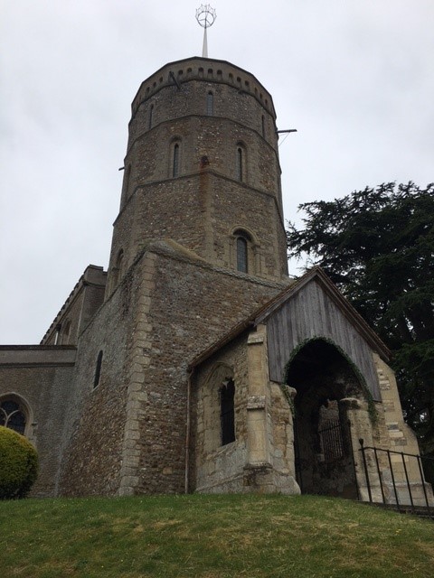
Look for the end of the green with the church, war memorial and children’s swings. Head for this end of the green, walking on the opposite side of the green to the church. Walk past the bus shelter and red telephone box to your right. Then follow the road as it curves round to the left, in between two white houses (one on either side of the road).
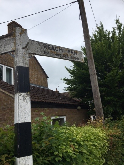
Stay on the road, following the sign to Upware and Devil’s Dyke walks. Ignore the public byway to the left, continuing along the road as it curves right and then left. You will then see an old sign indicating Upware to the left and Reach Fen to the right. Take the track towards Reach Fen.
In just a few metres, cross over a small stream and turn left along a track, with the stream on your left. Keep on this track for some time, including when it becomes a small gravel road and twists its way past farmhouses and buildings on your right.
When you reach a tarmacked road creating a T-junction, ignore the farm track continuing ahead and instead turn left onto the road, then cross a bridge. Immediately after the bridge, leave the road to turn right onto a signposted public byway.
Very soon you will pass allotments on your left; you’re now walking along the byway with a hedgerow to your right. Look over fields to your left and you should see the windmill and water tower at Swaffham Prior. Follow this track round a couple of bends. Soon another hedgerow springs up on your left, then the right-hand hedgerow disappears giving you views across fields.
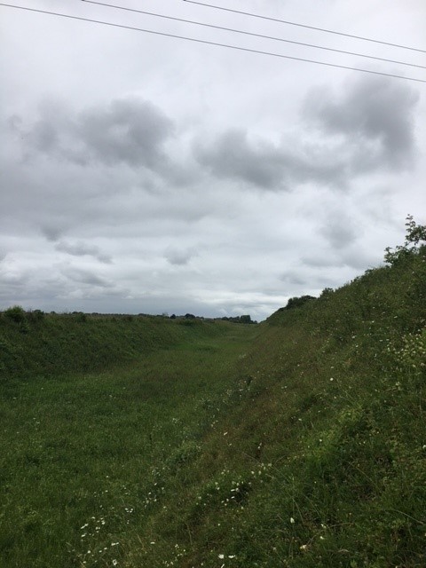
When you step up onto Devil’s Dyke you get a great sense of its size, and just how effective a defence it must have been
You will see that you are coming to a wooded area that stretches out to the right of the track. On reaching these trees, continue ahead to join a wider farm track. Shortly after, you will reach a tarmacked road; this is the road that links Reach with Swaffham Prior.
The route of our walk sees you turning left onto this road. However, if you have time, it is worthwhile turning right to explore Swaffham Prior before returning to this spot (see ‘Extending your walk into Swaffham Prior’ below).
Soon after turning left onto the road, you will see a concrete road to your right. Just after that, take the footpath going into trees. The footpath is signposted for Devil’s Dyke and Reach.
Where the path forks in the trees, take the right-hand option. It soon emerges with a large hedgerow on your left and fields on your right. Continue ahead, along the left-hand edge of the field.
Quite soon you will drop down onto what was once a railway line. Turn right, and in just a few metres, take a footpath rising to your left. When the path takes you along the edge of a field, you have your first view of Devil’s Dyke ahead: an impressive high embankment that stretches as far as you can see to your left.
Soon, follow a footpath sign into a hedgerow. You will dip down steeply into the ditch, and then climb up wooden and earth steps. Swing round to your left, and you are now on top of the embankment of Devil’s Dyke.
From the top of Devil’s Dyke you have fantastic views in all directions. You can see the windmill of Swaffham Prior behind you, and Devil’s Dyke extending away from you for several miles. As you look ahead towards Reach, over to your right there is the church and windmill of Burwell. And way over on the horizon, at about two o’clock as you face Reach, you can see Ely Cathedral, some ten miles away.
Walk along the top of Devil’s Dyke all the way into Reach. After a while it becomes bordered by hedgerows on both sides, and then emerges down onto the village green that was the start of the walk.

A quick guide to Devil’s Dyke
When you step up onto Devil’s Dyke you get a great sense of its size, and just how effective a defence it must have been. The ditch is very deep and very wide, and coupled with the height of the embankment makes for an intimidating defensive barrier.
It runs for over seven miles from Reach to Woodditton, south of Newmarket. It’s the largest of several similar ancient defences in Cambridgeshire. It was built to block a corridor through what was otherwise water-logged marsh or forest. As well as keeping out invaders, it was also most likely a way to control trade in and out of the area. However, archaeologists believe it may have been used for just a short time, based on findings in the ditch.
The hardest question of all to answer is: when exactly was Devil’s Dyke built? It likely dates from the Anglo-Saxon period of 410 to 1066, and more specifically during the 6th and 7th centuries. This was a period of warfare between East Anglia and Mercia, a kingdom reaching as far as what we now call Wales to the east, Yorkshire to the North, and Surrey to the south.
Warning: there is more than one Devil’s Dyke. That’s right, there is another Devil’s Dyke, in Sussex. So be careful if you download directions or set your SatNav! Click here for further information.
Extending your walk into Swaffham Prior
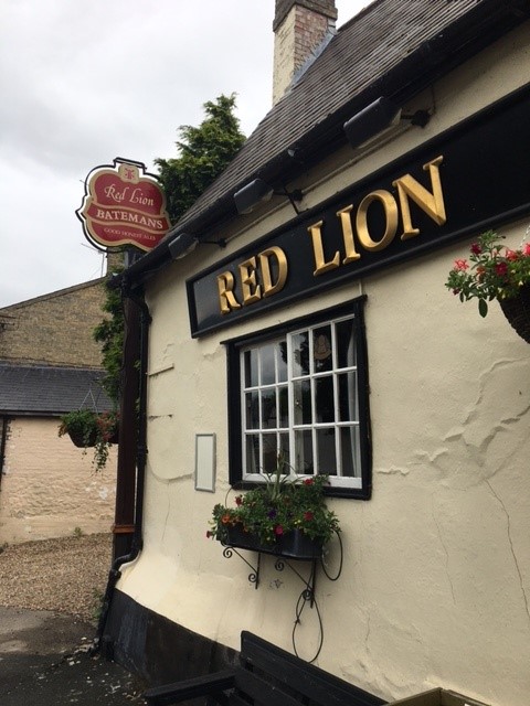
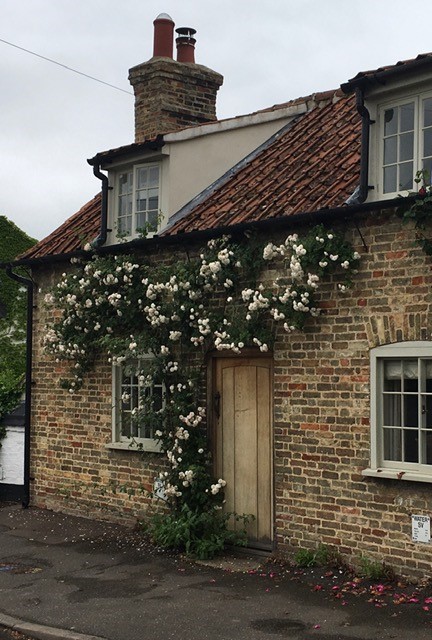
As mentioned above, when you come to the road between Reach and Swaffham Prior, it is worth turning right and heading into Swaffham Prior for a look around. It’s a delightful village, with lots of quaint cottages with front gardens in full bloom in the spring and summer – a classic English country experience.
I had an excellent pint at the also excellent Red Lion, an 18th-century pub with loads of character. Then I headed up to the real standout point of interest: the two churches sharing the same site.
The Church of St Mary and the Church of St Cyriac and St Julitta once served two parishes. Nowadays there is just one parish, but the two churches remain side-by-side. It’s an odd sight indeed, but also a very calm and peaceful spot to spend some time.
WORDS Richard Groom